Grenaa Strategic Spatial Plan
Like many coastal towns, Grenaa must be protected against future permanent sea-level rise and storm surges. Uniquely, Grenaa requires both coastline climate adaptation as well as flood mitigation along the Grenaa River, which runs through the town. Our winning competition proposal outlines a strategic, adaptive, and flexible plan for development with Grenaa’s maritime DNA as its foundational narrative.
Water as Origin and Threat
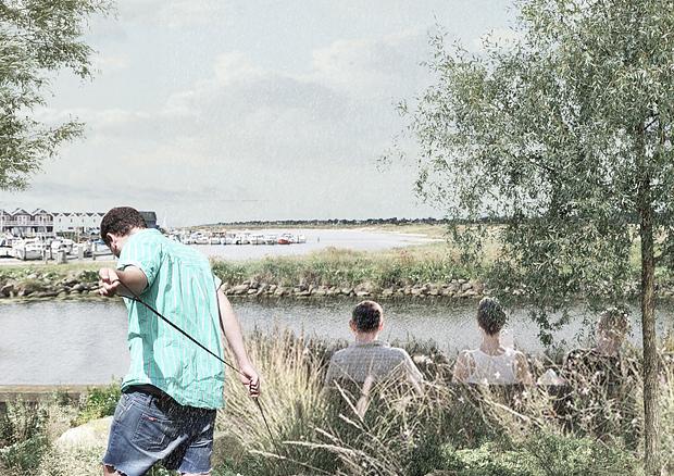
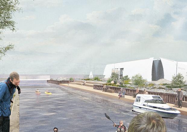
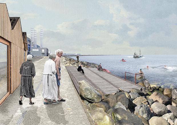
Proximity and access to water, with the river as a connecting thread, first put Grenaa on the Danish map. The city’s relationship with the sea began as a practical necessity and has evolved into a key attraction in recent decades. Yet that same proximity now poses a threat. We believe nature’s awe‑inspiring, and at times fearsome, power can be harnessed and staged in Grenaa as immersive water experiences. This approach creates value for the local community, settlement strategies, and sustainable tourism.
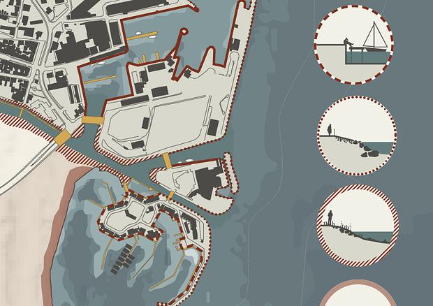
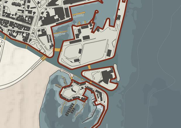
Grenaa Harbor is a resilient working area, acting stoically as a buffer between town and sea. Its purpose is to resist and tame the sea’s brute force. In contrast, the surrounding land and the river’s close inland areas are more vulnerable. The edge facing the sea is unprepared for rising water levels and more frequent storms. Therefore, the city’s waterfront must be protected without compromising the harbor’s functionality or qualities. The river mouth is especially sensitive: where water leaves, it can also enter. That area must receive special attention, balancing water as both an asset and a threat.
Main Strategy
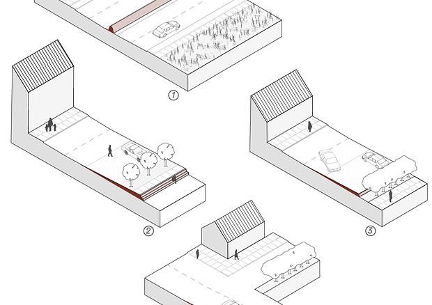
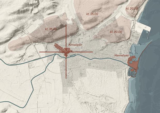
Our key strategy allows storm surge water up to the historic shoreline along Strandgade and Route 16. We also divide the harbor area into islands so that under normal conditions surface water cannot flow freely from one island to another. Two canals are proposed: One runs by the Kattegat Center to prevent overflow from the ferry port area from reaching the center on land. The other is on the east side of Route 16 to prevent harbor-originating surface water from entering the town.
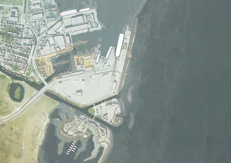
New Connections
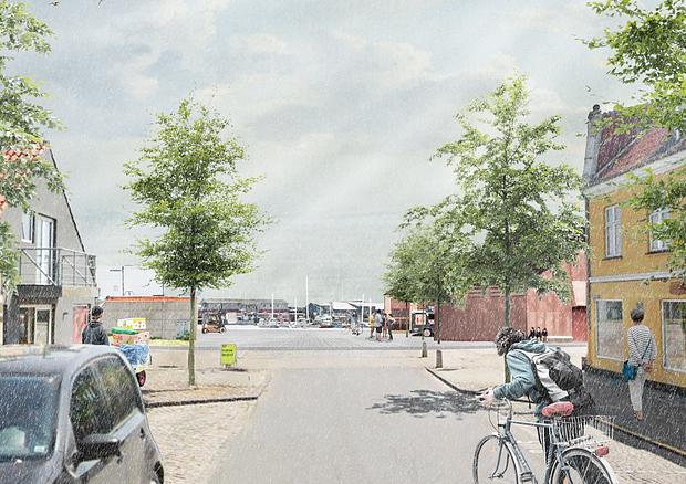
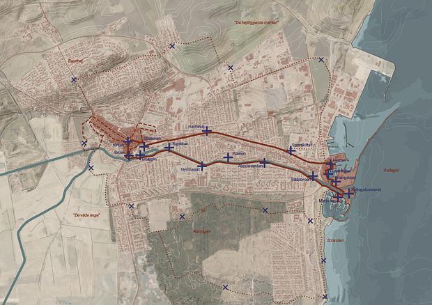
There is also a strong emphasis on engaging the town and local stakeholders in the planning process. Beyond climate resilience, we propose new urban connections that enhance attractiveness for residents and visitors while strengthening the bond between city and harbor. We will expose the river so it regains a prominent role, approximating its original status through visibility and new functions. The old railway tracks will be repurposed into an activity loop, punctuated by various destination points along its course. Additionally, we propose three themed connections:
- The Historical Route: A narrative trail highlighting the city’s cultural heritage.
- The Southern Nature Route: A walk along the Kattegat coast, beaches, forests, and wetlands at the foot of Grenaa.
- The Elevated Route: Highlighting the production and agricultural landscape, where open fields connect historically to Baunhøj Mill. It then continues toward the modern industrial landscape, including the northward railway and North Harbor.
This project won first prize in an invited competition, in collaboration with Norrøn and NIRAS.
1. præmie i indbudt konkurrence.
Place
Grenaa
Client
Norddjurs Kommune
Completed
2022
Role
Totalrådgiver
Collaborators
Norrøn og NIRAS